Are you dealing with...
Delays caused by inaccurate or incomplete survey data?
Construction rework because of wrong levels or alignments?
Survey information that doesn't match your design plans?
Difficulty coordinating multiple contractors on-site?
Missing as-built records or outdated site maps?
Costly disputes over boundaries or quantities?
Engineers waiting on data before they can start?
Struggling to verify earthworks volumes and progress?
Projects running over budget due to measurement errors?
Data that slows decision-making instead of speeding it up?
Consurv provides accurate and reliable engineering surveys across Southern Africa. You get precise data, fast turnaround, and clear communication from experts who understand how accuracy drives progress.
Engineering Surveys
Made Simple
We make the process straightforward so you can focus on what matters — completing your project safely and on time.
Consultation and Scoping
You discuss your project goals with our team, and we define exactly what needs to be measured and delivered.
On-Site Data Collection
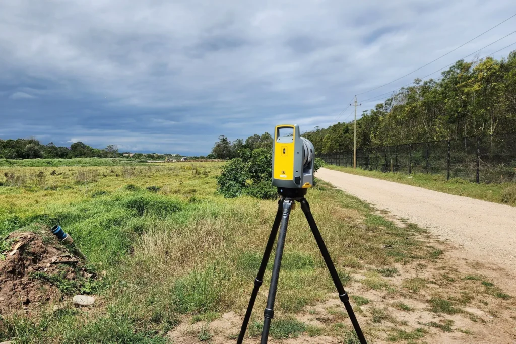
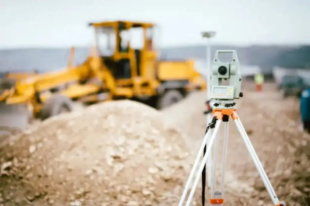
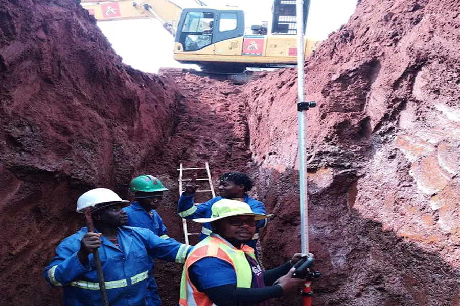
We capture precise data using advanced GPS, drones, and total stations for high accuracy and consistency.
Processing and Reporting
We process, analyse, and deliver clean, usable results — including models, CAD drawings, or volume reports — ready for immediate use.
Types of Engineering Surveys
We Address
Engineering surveys support every phase of infrastructure and construction development. Here are the main types we deliver:
Transferring design data accurately to the field for construction, ensuring every structure is built where and how it should be.
Capturing surface features, elevations, and contours to support design, planning, and site analysis.
Verifying completed work against design drawings to confirm compliance and identify deviations.
Establishing geodetic control points for consistency and precision across large or multi-phase projects.
Mapping and recording underground and surface utilities for safe excavation, planning, and maintenance.
Calculating cut-and-fill volumes and monitoring progress for accurate billing and project control.
How Consurv Delivers
Engineering Surveys
ADVANCED TECHNOLOGY
Accurate Data Every Time
We combine GPS, drone photogrammetry, and total station methods to achieve sub-centimetre precision. Each project is verified using multiple data sources for consistency.
So that you make critical decisions with complete confidence in your data.
AUTOCAD & CIVIL 3D MODELLING
Ready-To-Use Project Data
Our deliverables are generated in industry-standard CAD formats. You receive clean, organised data that integrates easily with your engineering and design tools.
So that your team can move from design to construction without data delays.
DRONE MAPPING
Faster Site Coverage and Insight
Using UAVs, we capture large areas quickly and safely, producing detailed orthophotos, terrain models, and volume analyses with rapid turnaround.
With drone surveys, you save time, reduce costs, and get a full picture of site progress.

QUALITY CONTROL
Verified and Audited Results
Each survey undergoes internal quality checks, ensuring data accuracy and compliance before final delivery. Our processes meet strict engineering standards.
So that you never have to second-guess the results you receive.
CLIENT COMMUNICATION
Transparent Project Updates
We keep you informed through every step, from field progress to final report submission. You get clear updates and fast responses to your queries.
With open communication, you stay in control and confident in project outcomes.

You deserve survey data that's as solid as the structures you build.
Additional Surveying
Services
In addition to engineering surveys, Consurv provides a wide range of specialised surveying services to support every project stage:
Volumetric surveys, blast grids, exploration, and monitoring for open cast and underground operations.
High-resolution mapping and contour plans using drone and GPS technology.
For residential, commercial, and infrastructure planning, including layout, subdivision, and boundary mapping.
Ongoing monitoring to verify accuracy during and after construction.
What Sets Consurv Apart?
One-stop surveying partner for civil, mining, and structural projects
Advanced drone, GPS, and CAD technologies
Daily data delivery and fast turnaround
Proven experience with projects across Southern Africa
Team of qualified geomatics and engineering surveyors
Transparent, reliable, and results-driven approach
Ready to Restore Your
Project Accuracy?
Don't let inaccurate data slow your project or cost you more in rework. Consurv is available across Southern Africa to deliver precise, actionable survey data that helps you stay on schedule and within budget.
With experience in civil, mining, and infrastructure projects, our team delivers measurable accuracy that drives real progress.